Mon 9 Sep 2013
Colorado 2013, How I Got the Snot Kicked Out of Me by the Altitude
Posted by Administrator under Backpacking and Hiking Trips , Colorado Trail Hike 2011No Comments
In 2011, I hiked the 500 mile Colorado Trail from Denver to Durango. It was the best 5 weeks of my life. (Read about it from the beginning.) So, when the Colorado Trail Foundation added another 80+ miles on to the trail this year, I HAD to hike it. It looked like it would rival the most scenic parts of the trail. Best friend, Sandy, would be joining me for the hike. This would be her fourth backpacking trip. Nothing like skipping directly to the advanced backpacking.
Day 1 – September 3, 2013 – 9 miles
At 12:45, Wild Bill, owner of the Leadville Hostel (best hostel in the world!), deposited us at Twin Lakes, 80+ trail miles north of where we parked our rental car at Monarch Pass.
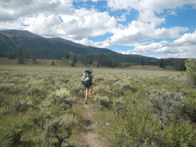
We started walking across the Twin Lakes damn. A mile later we were already off trail, having missed a turn somewhere. Drrr. A little cross country walk and we were back on track. Two miles in we’d reached the place where the Colorado Trail splits. To the left was the route I’d taken 2 years ago when I did the whole trail. To the right was the new section which rejoined the old CT about 82 miles south. From now on, it was new territory for me…virgin territory as Sandy called it while singing Madonna’s “Like a Virgin” to me. That freaking song stuck in my head for days. Thanks, Sandy. [mean face]
The first 4 miles were easy hiking…a walk around the lake at 9,000 ft. Then we started to ascend toward our goal for the day – tree line at 12,000 ft just below Hope Pass.
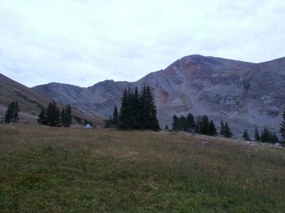
We made it by 7pm, hiking through rain, and just in time to set up the tent in a downpour. Once the rain let up, I made supper for us – Mountain House freeze dried Beef Stroganoff for Sandy and Beef Stew for me. Neither of us had much of an appetite thanks to the altitude so we each ate about half and saved the rest for the next day’s breakfast. By the time we cleaned up and turned in, it was well past dark.
Day 2 – September 4, 2013 – 9 miles
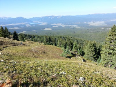
Camping just below Hope Pass meant a long, slow trudge up to the pass first thing in the morning, which got our blood pumping and kept us warm. Then a steep descent with beautiful views down to the ghost town of Winfield. As we hiked out of Winfield, I said something to Sandy about doing Mt. Huron, a 14er (14,000+ ft mountain – 1 of 55 in Colorado) that was just 2.3 miles off the CT) the following day. She was game. We hiked to Mt. Huron trailhead. And just as we got there, the clouds let loose. I set the tent up while rivers were forming under it. (Lesson learned: never set up a tent on bare dirt when you can put it on a grassy area instead.) Knowing full well that everything was going to get drenched and covered in mud if we attempted to transfer the stuff from our packs to the tent, we decided to wait out the storm under the shelter of some pine trees. Then the hail started. It didn’t take long until the ground was covered in small white pellets of ice. 45 minutes later the storm was still in full force and we were both getting cold and CJ was shivering uncontrollably on my lap. It was time to act.
We got in the tent and soaked up the puddles that had formed while setting it up and the mud that sprayed in from the driving rain. Then I passed the packs under the rain fly in to Sandy with the pack cover side down in the mud. She unloaded the contents and set up the sleeping pads and bags. I got everything settled outside and dove into the tent. Till all was said and done, we’d managed to keep the most important things that we’d need to keep warm overnight dry or just damp. Another hour or so later and it was down to a drizzle. I tore myself from my warm sleeping bag, put on my wet socks and shoes, and went down to the water source (a small lake) and filtered the water we’d need for the night and the hike up Mt. Huron the next day.
When the drizzle stopped, we hung out all our sopping wet stuff on a downed tree and made supper. After supper, we pulled our still sopping wet clothes into the bottom of the tent, and turned in around hiker midnight (7 pm.)
Day 3 – September 5, 2013 – 3 miles
Plans of hiking Mt. Huron were replaced by the need to dry things out from yesterday’s downpour. Everything was either soaked or damp. And given the cool temps at 10,000 – 12,000 ft, it was prudent we got things dried out.
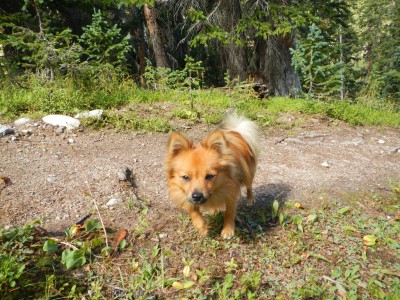
At first light, we got up and packed the cold, wet gear into our cold, wet packs as CJ explored and tried to run off with our socks. Ahead of us were 2 moderate uphills followed by 2 grueling, steep uphill miles in which we’d gain 2,000 ft in 2 miles.
I took off hiking at a comfortable clip feeling good. When the path started to steepen, I started pushing it, thinking I’d conquered my issues with altitude. I left Sandy notes along the way – arrows in the dirt to direct her at intersections, paper notes held down by rocks in the middle of the path to let her know how far she had to go.
I made it up to Lake Ann, an alpine lake at almost 12,000 ft, and emptied my pack, spreading the contents on the ground to dry in the bright sun and dry air. Just as I started heading back down the trail to meet Sandy, she crested the hill to the lake.
We scattered the contents of her backpack on the ground to dry and sat down to eat a late breakfast and waited for the stuff to dry.
And then it hit. It no longer mattered that I was sitting in the most beautiful spot I’d ever been in my life. My focus was on trying not to hurl or pass out. (And we all know my #1 rule in life is no hurling at any cost.) The altitude had caught up with me. I shouldn’t have pushed.
I contemplated throwing in the towel and crawling back down to the trailhead for Mt. Huron where we’d camped the night before and hitching a ride out. Then I remembered reading Cookerhiker’s (fellow CT thru-hiker) blog and his day 3 hell. Every time he’s done a backpacking trip at altitude, he felt horrible on day 3. Day 4, he felt great again. Today was day 3 for us. Hoping his day 3 theory worked for me, we packed everything up and hiked (SLOWLY) back down to treeline for the shade. We chilled out there for a couple hours waiting for the inevitable cloud cover that develops everyday to overtake the sun. I started feeling not so rotten but not good enough that I wanted to tackle the remaining 800 ft in .8 miles over the pass.
Once the full sunshine was intermittent, we hiked (SLOWLY) back up to Lake Ann and set up camp for the night…at 1pm. ![]() We’d made a whopping 3 miles progress for the day.
We’d made a whopping 3 miles progress for the day.
Once I got over my fear of not being able to finish the 80+ miles, I started enjoying the amazing views again and was glad we’d be spending the rest of the day and night at Lake Ann. And best of all, we set the tent up in the sun and not a downpour like the last 2 nights. And we had the place to ourselves. A couple hiker/hunters came down to the lake for water but we couldn’t even see where they were camped.
By 4pm the temperature had dropped considerably and the hail was flying and thunder booming but we were nestled dry and cozy in the tent. It rained on and off all evening and stopped long enough to cook supper. Just after dark we got company – some hikers set up camp about a 100 yards away.
Day 4 – September 6, 2013 – 8 miles
Woke up at 6:30 feeling better, although still not 100%. I was dreading the climb over the pass. My plan was to take it super easy…and not hurl. By 7:30 we were off. By 7:35 I had gotten into a groove:
Take 20 steps. Stop. Count to 20. Don’t hurl.
Take 20 steps. Stop. Count to 20. Don’t hurl.
….
By the time I was nearing the top of the pass, it was:
Take 10 steps. Stop. Count to 50. Don’t hurl. Don’t pass out.
I made it. And boy was the view worth it. We continued down the other side of the pass and down into tree line.
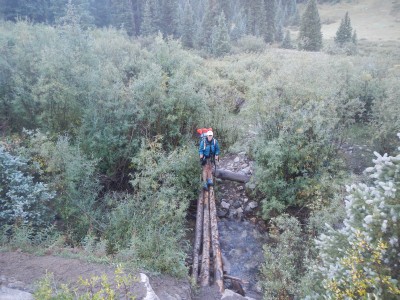
We were both feeling pretty scrungy, it being day 4 of not showering and wearing the same clothes. We stopped at a flowing creek and took a hiker bath in the privacy of the tall underbrush. This stream was also one of the two possible camping spots for the day. But it wasn’t even noon yet so we decided to push on another 5 miles to the next spot since it would be mostly downhill.
About 2 miles on I started feeling rotten again. Another .5 miles and I’d reached my limit, hit the wall harder than I’d ever hit it before on any run. I felt like I couldn’t take another step. My chest felt tight. I couldn’t take a deep breath, and my breathing and heart rate were through the roof and wouldn’t calm down with resting. I took my pack off and sat down and willed myself to not hurl or pass out, and wondered how in the world I was going to make another 2.5 miles to the next watering spot. That distance might as well have been 100 miles and up Mt. Everest at that. Just impossible at the moment. Sandy and I talked. (I omitted the details about the pressure in my chest and breath and heart rate at the time so I didn’t completely freak her out.) We were at a section that wasn’t campable. Every direction was too steep to pitch a tent. After a rest, Sandy hiked ahead to see how far to the next relatively flat section. About .1 miles. Even that seemed insurmountable. Sandy took my pack for me and I walked at a snail’s pace to the area. We set up camp and waited out another storm before Sandy set off for water another .5 miles down the trail.
We made supper and settled in for a long night.
Day 5 – September 7, 2013 – 2.5 miles
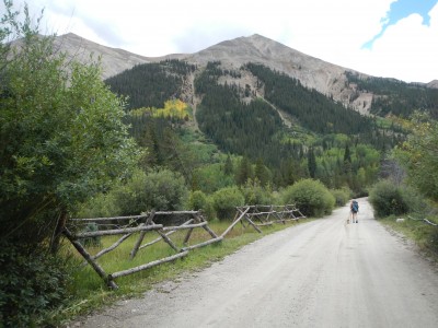
I hardly slept, still feeling pretty crappy, and wondering how I was going to make it out the 2.5 miles to a potential bailout point the next morning, despite it being entirely downhill. We got up and packed and hit the trail. I hadn’t eaten hardly anything for the past couple days and still had zero interest in food. I took it at a snail’s pace. But still, 1.5 miles later, I had to stop. I was beyond any limit I had ever reached before. We rested for a while and I forced down my gummy vitamins and a piece of jerky. Then continued on for a mile or so. About .3 miles from the bottom of the valley, we started hearing a chainsaw. I sat down and waited while Sandy continued on to investigate. It turned out to be a husband and wife and her brother who had set up an elaborate hunting camp on BLM land for 2 weeks.
I forced myself down the last bit of trail to their camp. The people were amazing. The brother was an ER doctor who also struggled with altitude sickness so he knew exactly what was going on. His remedy was a huge handful of Tums to get rid of the acidity in my system that apparently builds up from over-exertion and oxygen deprivation. Within an hour I was rallying, no longer on the verge of hurling or passing out. They offered their extra shelter to us for as long as we needed and offered to drive us a mile out to a point where we could walk another 2 miles to a turn-around point for ATV’s. I didn’t have the 2 miles in me yet so we just hung out for a while until 3 ATV’s showed up who gave us a ride down to Taylor Park Trading Post (what was supposed to be our resupply point) where we could hitch a ride out to the main road and back to our car. We were at the Salida Hostel by 3pm thanks to the generosity of a couple on a weekend vacation who took a liking to CJ.
Getting down to the lower elevation of Salida (7,000 ft) helped things immensely. I was still drained but didn’t feel so horrible. We stayed in Salida for the night, then headed back to the Leadville Hostel to recuperate for a couple days before we either continue on the trail or just do a few 14ers.
To be continued…


